Ocean Globe

Title: Ocean Globe
Author: Joe Breman
ISBN: 1589482190 / 9781589482197
Format: Soft Cover
Pages: 274
Publisher: ESRI PRESS
Year: 2010
Availability: Out of Stock

Tab Article

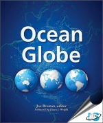
Ocean Globe addresses the recent progress in seafloor documentation, bathymetry, and related ocean and marine mapping projects using geographic information systems (GIS) by scientists and educators around the world. Each chapter represents a different facet of maritime research that relies on ocean floor mapping for its success. Ocean Globe is both a resource in the classroom and a reference for practitioners.

Tab Article

Foreword
Preface
Acknowledgments
Introduction

Chapter 1 : Bathymetry : The Art and Science of Seafloor Modeling for Modern Applications
Chapter 2 : Seamlessly Integrating Bathymetric and Topographic Data to Support Tsunami Modeling and Forecasting Efforts
Chapter 3 : Channel Habitat Atlas for Marine Resource Management : An Aid to Managing a Resource : Stressed Marine Area
Chapter 4 : California's Seafloor Mapping Project
Chapter 5 : Hawksbill and Green Sea Turtles : International Voyagers of The Atlantic and Pacific Oceans
Chapter 6 : Mysteries of The Not : So : Deep : An Investigation Into Gray Whale Habitat Use Along The West Coast of Vancouver Island
Chapter 7 : a Perspective From The Hawaiian Archipelago : The Value of a Bathymetric Data Model for Underwater Habitat Mapping
Chapter 8 : Northwestern Gulf of Mexico Bathymetry and Geomorphology
Chapter 9 : Geologic Characterization of U.S. Shelf Areas Using Usseabed for GIS Mapping, Habitat Delineation, and Assessing Marine Sand and Gravel Resources
Chapter 10 : Marine Landscape Ecology of Coral Reefs Emerges From Developments In Seafloor Mapping, Gps, and GIS
Chapter 11 : Coastal Aquaculture Site Selection Using Remote Sensing Data and GIS
Chapter 12 : Developing Nearshore Bathymetry to Analyze a Noxious Seaweed Along The South : Facing Shore of Harwich, Cape Cod, Massachusetts

Appendix : The History of Seafloor Mapping
Index